Document

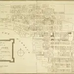
A PLAN OF THE TOWN OF ST JOHN IN THE ISLAND OF ANTIGUA
A plan of the town of St John's, Antigua, drawn in 1788 by Surveyor General John Killian. By this time the town had become an important trading centre. Situated at the head of a natural harbour, the area was ideal for settlement, eventually becoming the capital and administrative centre of the islands of Antigua and Barbuda. The plan shows the layout of the streets and records the location of churches and other public buildings. Private properties have been marked with the names of their owners.
The British LibraryKillian, John. Surveyor.
1788
1790

