Document

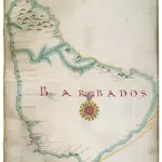
Map of Barbados
This is a map of the island of Barbados and is from the late 17th century. It shows the coast of the island in detail, harbours are marked with an anchor, and rocky areas are shown with a series of small crosses and a yellow line. The names of settlements are marked, and, in the centre of the map, a compass rose orientates the map to the North.
The British Library1680

