Document

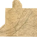
Prang's War Map. Eastern and Western Viginia
This map details the Upper South/Border States in 1861. Smaller maps show the North Carolina coastline and Virginia in detail. Around the border are ten ‘eminent patriots’, the leading generals of the Union Army at the time of the map’s production. Amongst them is General Anderson, who attempted to defend Fort Sumter at the outbreak of the war, General Burnside with the facial hair that would inspire the description ‘sideburns’ and General Meagher who commanded battalions principally composed of Irish-born and descended soldiers. On the top right is General George B. McClellan, commander of the Army of the Potomac and general-in-chief of Union forces in the first part of the war. He later ran for the presidency in 1864. All these generals led campaigns in the regions depicted on the map.
The British Library1861
L. Prang & Co.

