Document

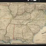
Map of the Southern States of North America, with the Forts, Harbours, and Military Positions
Map of the Southern States of North America, with the Forts, Harbours, and Military Positions. This map, published by Wyld in 1865, shows much of the Confederacy and the Border States as they were at the end of the Civil War. The divide between Virginia and West Virginia is marked, along with ‘forts, harbours & military positions’. The dark black lines indicated railway routes and it is notable how many more there are in the small segment of the Northern states displayed at the top of the map in comparison to the Confederate states.
The British Library1865
J. Wyld

