Document

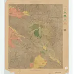
Land Classification and Density of Standing Timber: California San Jacinto Quadrangle Plate CXXV
Relief shown by contours and spot heights. "Surveyed in 1897-98." "R.U. Goode, geographer in charge; triangulation by A.H. Sylvester; topography by E.T. Perkins, Jr. and A.H. Sylvester. Henry Gannett, geographer in charge; land classification by John B. Leiberg." From: U.S. Geological Survey. 21st Annual Report, part V, plate CXXV. Contour interval 100 ft
UCLA LibraryGoode, Richard Urquhart, 1858-1903. / Sylvester, A. H. / Perkins, E. T. / Gannett, Henry, 1846-1914. / Leiberg, John B. (John Bernhard), 1853-1913. / Julius Bien & Co.
1898
Geological Survey (U.S.)
1:125 000

