Dokument

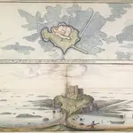
A colored "ground plott--of Rockain Castle, on the west side of the island of Guernsey;" drawn in 1680, by Thomas Phillips, on a scale of 22 1/2 feet to an inch.
his colored map and view of Rockain Castle, located on the west side of the island of Guernsey, was drawn in 1680 by Thomas Phillips. It is from a larger report prepared for King Charles II in 1680-81: 'THE PRESENT STATE of Guernsey with a short accompt of Iersey and the Forts belonging to the said Islands, by Col nll George Legge [Baron Dartmouth, 1682], Lieutenant-General of His Ma ties ; Ordnance', 1680, with elaborately-coloured title-page enclosing, at the head, the royal arms and, at the foot, arms and crest of Legge, and many charts, plans, and views of Guernsey, Jersey, and Sark by Thomas Phillips, Engineer. On f. 2 is the letter of Col. Legge, dat. 9 Jan. 16 80 / 81 , presenting the report to King [Charles II].
The British LibraryThomas Phillips
1680

